We crossed the Continental Divide at Vermillion Pass.
A
lso the boundary between Alberta and British Columbia, and the boundary between Banff and Kootenay National Parks.
Vermillion....named for the ochre that Kootenay Indians used to make into red paint. Unfortunately we will not be able to see the Paint Pots this trip, although it had been one of our planned stops.
There are 4 National Parks in the Canadian Rockies. You can see where Kootenay is on this map (the blue area on the enlarged portion). We will have to discover Yoho NP another trip.
Parked at the entrance to Kootenay NP. There is a hiking trail here.
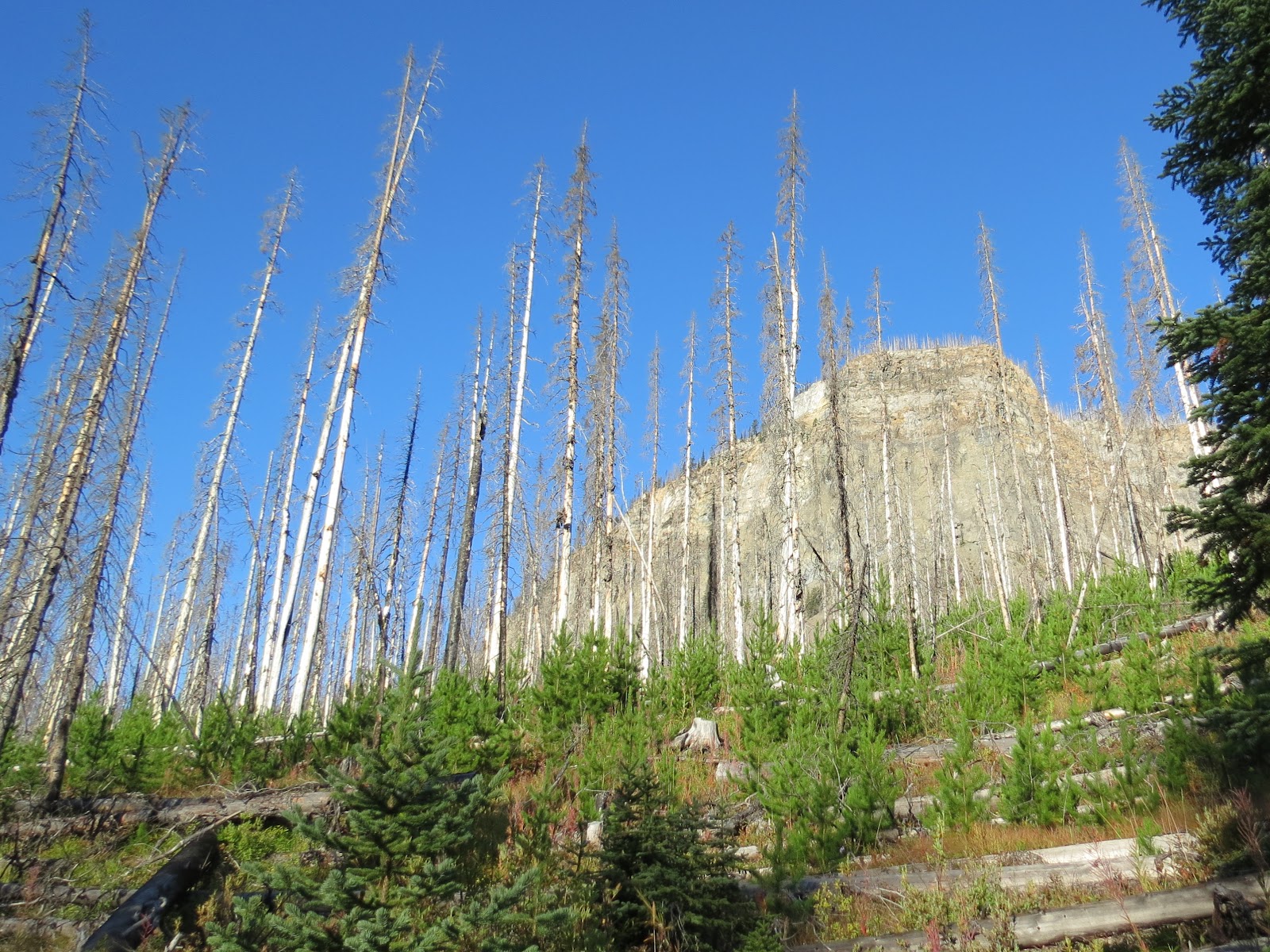
The Fireweed Trail will take us through an area of forest that burned in 1968. We will discover the changes and regrowth that have occured since then.
Informational signs were attached to the remains of burned trees.
It was still early on a chilly morning.
Remains of huge trees still litter the forest floor.
But a new forest is emerging.
New framed by old.
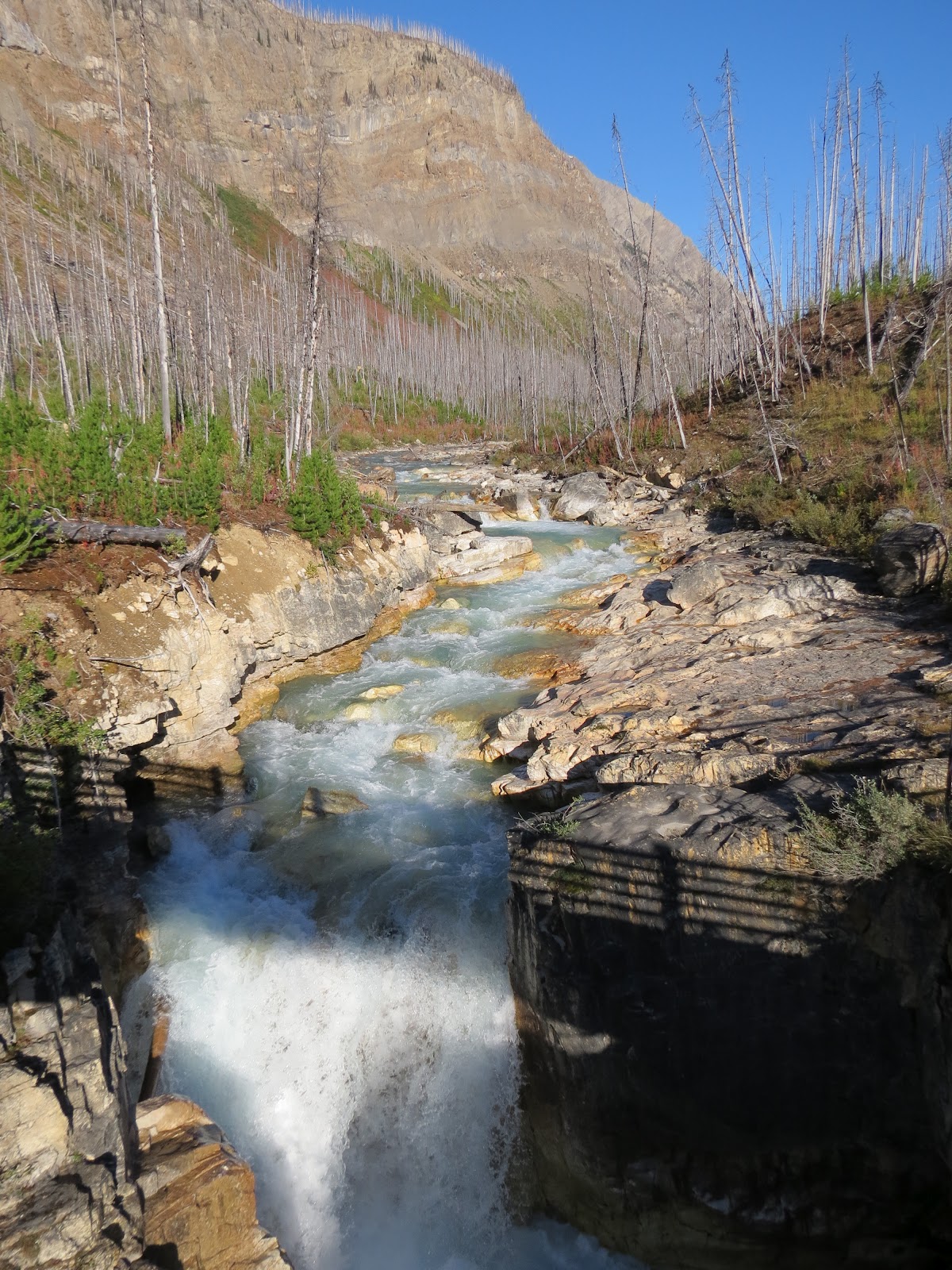
Our next stop was at Marble Canyon where we find the remains of a newer forest fire, in 2003, just 9 years ago.
And there is another interesting walk here on boardwalks that follow and cross the canyon several times.
We will follow this creek to the canyon.
We can begin to see evidence of the 2003 fire.
High on the ridge of the mountain, burned trees stand like sentinels.
Only a few large trees remain.
Looking down into the canyon.
The canyon was formed by glacier activity.
Marble Canyon
The higher we go, the deeper the canyon becomes.
This sign informs us that the bridge has washed out to the Paint Pots down the road from here, and we will not be to access it unless we want to hike from here and back. We didn't.
But the canyon trail is open, so on we go.
The canyon is so narrow and deep that the sunlight can't reach it.
It is dark down there.
We come to that high valley we read about on the sign...Prospector's Valley.
You see how small the new trees are compared to what we saw at the site of the older fire. These trees are just about 9 years old.
THe steep sides of Marble Canyon.
Colorful rocks
We come to the falls at the top of the canyon.
About the falls.
As you can see there are two falls.
The upper falls.
The new trees here are no taller than the fireweed.
The creek above the falls.
Our trail ends here, but it would be interesting to follow the creek up the valley...just to see what's around that next bend.
Where the lower falls enter the canyon.
Mist from the falls rises out of the canyon.
Just appreciating all the colors...
We skipped the parking area for the Paint Pots, as the access was closed. On to our next stop beside the Vermillion River.
And a disappointingly short walk along the river to Vermillion Falls.
Nice, but not what I was expecting.
This view of the headwaters of the Columbia River from a rest area.
Another rest area...we could have spent the night here, but decided to head for the US border. It was time.
Checked out the birdlife first.
Good-bye Canada, until next time.


A last beautiful look at Canada.
ReplyDeleteI miss the colors of the rivers the most.....it is so hard to explain to anyone who has not seen them first hand.
ReplyDeleteBeautiful. And I for one am sad to see your Alaska/Canada journey end. But I look forward to your future posts in the Lower 48.
ReplyDeleteLove the Marble Canyon! Your pics look like watercolors!
ReplyDelete