Sunday, July 29, 2012

Sterling Highway and Skilak Lake Road

July 28, 2012
One more beautiful morning at our site on Homer Spit,
 One more walk on the beach,
 One more peek in the tide pools,
 One more chance to watch others having fun,
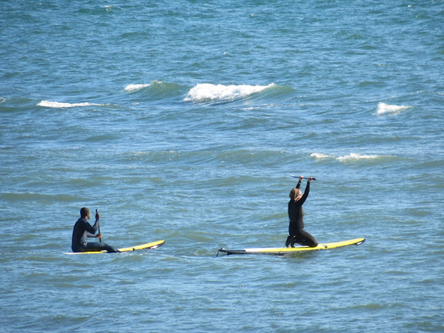
 Not sure what this sport is called, but they alternately sat or kneeled on surfboards and paddled with a long-handled paddle through the waves.
 I noticed they wore wet/dry suits.
One more stroll through the estuary to look at birds and wildflowers. This Common Redpoll doesn't look at all common in his bright breeding plumage.
God's flower arrangement.
Then I followed Birdie north out of Homer on the Sterling Highway. Notice Mount ReDoubt Volcano rising majestically in front of her.
Once past Soldotna, we decided to take a side route off the Sterling Highway through a wildlife preserve.
Skilak Lake Road is gravel for 18 miles. It was pretty, but the vibrations shook things up pretty good in my RV. 
Flowers at an overlook.
 A view of Skilak Lake.
 Rock Lake, a small lake provided some birding opportunities. This is likely an Alder Flycatcher....but those Flycatchers are hard to tell apart.
 But the best find for me was this Pacific Loon, a new one to me.
 There was a pair of them on Rock Lake.
 Note his gray head unlike the Common Loon I'm used to seeing.
 Pacific Loon
 Sorry, I took a lot of pictures of them.
 This is Hidden Lake where we hoped to stay in the campground, but it was a busy Saturday for fishermen, and the campground was full.
No wonder the fishermen like it....two kinds of salmon and 3 kinds of trout live here.
So we ended up in the overflow area of Russian River Campground...another favorite with salmon fishermen. On Sunday we were able to get a regular site in the campground.
We've decided to stay a few days and explore more of the area around Cooper Landing....and do chores like laundry. Birdie and I hiked the 2.3 mile trail up to Russian River Falls to see the salmon.  
 Birdie was excited to spot an American Dipper flying around the swift water, but I couldn't get a picture.
 They hike back down was easier, but our feet hurt and we were tired.
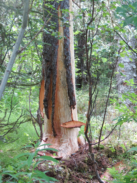
 This is most likely the work of an ambitious and hungry porcupine.
More from here next time.

Friday, July 27, 2012

on a Float Plane to Katmai

My birthday present to myself was a floatplane trip to Katmai National Park to see the Brown Bears. It was a beautiful morning in Homer.
Turned out to be a birthday present from Stellar Air, as we were not charged for the trip. The start was delayed a couple hours because weather was not good on Katmai...foggy and cloudy. Then it was deemed OK about 10 a.m.
 I sat in front. This was my view.
 Birdie sat in back with the chest freezer that was to be delivered.
Take off from Beluga Lake was uneventful. This is a view of the bluffs with Mt. Iliamna volcano in the distance.
 Mount Redoubt can also be seen. It last erupted in 2009. Steam still rises.
 Fishing vessels in Cook Inlet.
 Mount Augustine is a volcanic island about 70 miles from Homer.
 It last erupted in 2006. Two smoke plumes can be seen at its summit.
 Hardened lava flow on the side of Mt. Augustine.
 Augustine volcano from the back side.
Approaching the coastline of Katmai National Park and Preserve. You can see the Aleutian Range is shrouded in clouds.
A flat grass covered island in Kamishak Bay.
This is Kamishak Bay. On the map below you can see the McNeil River State Game Sanctuary just outside the borders of the National Park to the north.
There is a limited access campground here that is gained through a lottery system. Lucky lottery winners can camp here and see the Brown Bears on the McNeil River.
This is the only brown bear we saw...if you squint you can see him fishing for salmon in the middle of the river.
 Our destination was Brooks Camp and Visitor Center over the mountains. You can click on the map to enlarge it.
Radio traffic from other planes indicated they were not able to land at Brooks Camp due to heavy cloud cover. Much of the rest of our flight was spent searching for a break in the clouds to do that. 
Love the blue color of lakes and rivers caused by glacial silt.
 We did see some awesome wilderness in the process!


 You can see a waterfall in the lower left of this photo.

 THe pilot said sometimes they can follow a river in...
 Bet that would be an awesome waterfall to see up close.
 The side of this mountain had deep gorges.

 Waterfall that likely helps form the gorges.

 Sometimes we went lower between the mountains.
 So low with the wind buffeting us that I was worried about making it over this ridge.
 Whew, that was close!
And this is where the pilot said, "Huh!" Not what he was hoping to see over that ridge, I guess.

Two rivers converge, but Doug, our pilot, wasn't too informative about exactly where we were.
 So we tried climbing above the clouds so he could look for a "hole."
 More blue ice down there.
 Another valley.
 Wish I could tell you which mountain this is.
And this became our view for quite awhile. I was beginning to think if we found a hole and landed, the hole might close over and we wouldn't be able to get back out!
Flying between the clouds. We could see mountain peaks with clouds above and clouds below.

 Finally Doug gave up and headed back toward Homer. We began to see a little more land as we approached the coast again.
Doug took this photo out his side. It shows 3 volcanoes in a row... Augustine, Iliamna, and reDoubt.
 Barren Islands
 Not sure what these barges are carrying....garbage to dump maybe?
 The end of the Kenai Peninsula is on the left, Barren Islands on the right.
 Currents run like rivers in the ocean.
 An inlet in the Kenai Peninsula across Kachemak Bay from Homer.

 Snake wake!
 Safe splashdown! They will call us if the weather is better tomorrow, otherwise we will head out of Homer.
Here's a link to the live web cam of Brown Bear catching salmon at Brooks Falls....what we were supposed to see.