This is a view of the Nenana River coming into Fairbanks. The Nenana and the Chena Rivers unite in Fairbanks.
The first full day in Fairbanks was spent taking care of business...oil changes and service on our RVs. The night was spent at Walmart.
Birdie and I also drove by Creamers Field Migratory Bird Refuge. We plan to go there when my daughter and granddaughter arrive. We could see the flock of Canada geese above and the Sandhill cranes below from the parking area.
The next night we moved to Chena River State Recreation area campground, which as its name implies lies along the Chena River. Note the "palm trees" on the opposite bank.
That night we took Nan to the Salmon Bake for her birthday dinner. The restaurant is located inside Pioneer Park, so we looked around before dinner. Nan and Tina looking at President Harding's Pullman train car. Check out Tina's and other blogs about this day.
We went in some gift shops....look out, Birdie....behind you!
Nan seemed to enjoy the salmon, cod, and prime rib dinner. Not so sure about Tina?
Birdie and I decided to take a tour to the Arctic Circle. They picked us up at 7 a.m. at the campground. The trip was expected to take 15 hours, and we would be returned here at 10 p.m.
The road to the Arctic Circle is the same road that was built as a "haul road" for the construction and supply route for the Trans-Alaska Pipeline. That's still its primary purpose and big trucks traverse it all day long.
Our first stop after gas was at the pipeline. Our guide, Bill, is explaining about the construction of the pipeline and how it is designed to withstand earthquakes and freezing temperatures.
The first part of the road, the Elliot Highway, is mostly paved, but that doesn't mean it's in good condition. It is full of frost heaves. Slow is the optimum word here.
It was hard to get a good picture through the window as we bumped along.
We stopped for breakfast at a truck stop whose bathrooms were not working....they were working on the well. So at our next stop we found our own bathrooms....down there and to the left. I think I found the right spot, there was moose poop there.
The view from there, taken while standing still.
Wildflowers were abundant. Our tour guide named them all, but I already forgot the names.
Bill has lived "in the wild" near Denali for over 30 years with no electricity or running water, and has only recently bought a modern house closer to civilization. He has been in the tour guide business all that time too, so had a lot of knowledge. He pointed out the operations of several gold-mining claims along this stretch of the road.
The pipeline is buried underground in places where permafrost is not likely to affect it.
Our next rest stop had vault toilets, which was its most important feature. I always check out the trails...this one I learned is a winter trail.
Not recommended for summer because it is wet and boggy, as you can see.
Rules of driving on this road....all good advice.
History of the road.
I had already figured out I would not be driving my RV out this road, but if you want to there are places to camp along the way.
This mummified prehistoric steppe bison is on display at the Museum of the North in Fairbanks. I plan to take Jennifer and Ashley there.
Gold miners have uncovered many prehistoric remains in the area.
A view into the wild. When I see scenes like this I just want to sort of walk into them awhile. But not today, because the we must reach the Arctic Circle!
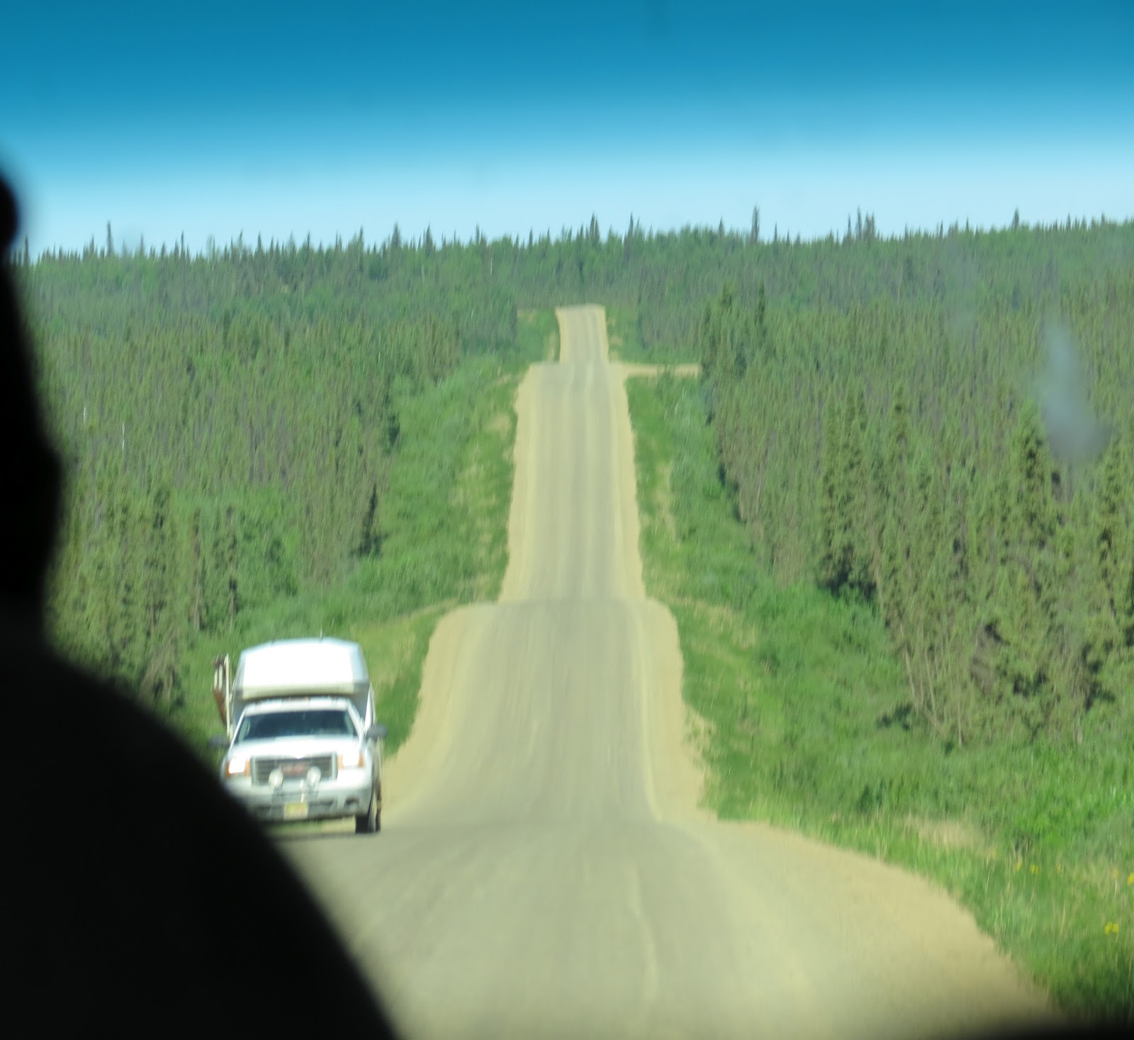
And now we have arrived at the beginning of the Dalton Highway, a road featured on the TV Show, "Ice Road Truckers," which tells you it's pretty bad.
Where the pavement ends...
My view through the windshield is limited by heads, mirror, and bug splats.
We will not be going all the way to Deadhorse today. Our destination is before Coldfoot which is about halway between Fairbanks and Deadhorse. You can see the pipeline next to the road on the distant hill.
Side roads along the way are access roads for maintenance on the pipeline.
Our driver had a few words to say about the stupidity of riding a bike on this road. No cell phone service or much of anything else out here. He, at least, has a CB radio to talk to the truckers.
Out my side window the view was beautiful.
Sometimes.
The view in front.
Note the stunted growth of the trees where the permafrost is close to the surface of the ground. These trees have a very shallow root system because of that.
The road is in constant repair all summer. Alaskans say they have just 2 seasons...winter and construction.
We had to wait for a pilot car to take us through this part.
What your car or RV will look like if you drive this road.
A good time to take a nap.
Here comes traffic from the north.
Our turn to follow the pilot vehicle.
Looks like a nice view at this rest area, but our driver didn't stop.
More views from the back seat...
Birdie is still asleep.
The road goes on and on, up and down.
Forest fires are left to burn here unless they are threatening the pipeline.
The road became a roller coaster in places:
This helicopter provides security for the pipeline
and the pumping stations like this one.
We stopped briefly at the crossing of the Yukon River,
and had to make out our dinner menu request for the return trip stop at the truck-stop restaurant across the street.
This is "sand hill," one of the most dangerous sections of road and featured in the TV show. It's a steep downhill with a steep uphill following.
We were very fortunate to see this moose and calf who ran off the roadway as soon as she saw or heard us coming. This was definitely not a wildlife tour.
More trucks and dust.
The best view of the road and pipeline together.
The markers on the sides help truckers find the road in winter. When traveling north keep the posts with 2 white markers on the right.
My favorite stop was at Finger Mountain. Aviators used this rock formation (Tor) as a navigating tool. The finger points to Fairbanks.
There was a trail to the top of this rock formation.
Forces of nature, granite rocks formed by magma, water and ice caused them split.
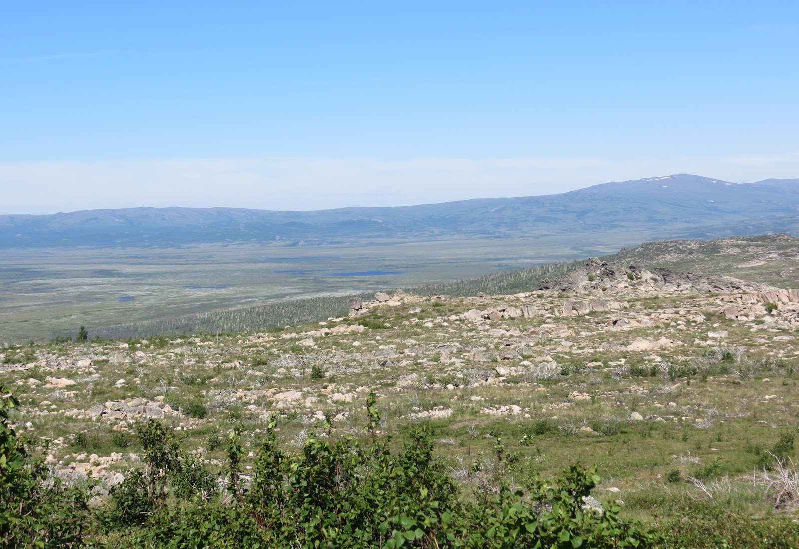
Melting snow and ice from the surrounding hills form these lakes in the basin below.
Tundra landscape and the foothills of the Brooks Range in the distance.
Just a little farther and we have reached our destination.
The photo showing we made it alive. There is nothing special about the landscape.
60 miles back to dinner, and 149 to Fairbanks.
Our van is pretty dirty.
Back at the Yukon River we looked over this tugboat.
And got a photo of the river. The water wasn't as cold as I thought it would be.
The salmon chowder I had for dinner was very good. Then back to photos through the window.
More trucks and more dust.
The sun never set, but the shadows got long.
More bumps.
And finally, The End.


Whew! I'd have been in the back seat with Birdie, sawing logs. What an adventure! Thanks for sharing, Liz. :)
ReplyDeleteI was really surprised to see no snow anywhere. It seems like there was plenty of it further south. That is definitely a once in a lifetime visit.
ReplyDeleteNo way I'd be sleeping thru that!! Excellent adventure. Thank you.
ReplyDeleteAn excellent trip as usual. I noticed you've been following the wild roses north. How nice to have them for so much of your trip.
ReplyDelete